
Have you ever wanted to know at what altitude you were? Maybe you were climbing a mountain and wanted to know how high you had reached, or maybe you were just curious. What if I told you that from your own mobile or on your computer you can know what it is your current altitude?
Actually, finding out this information is much easier than it seems. And you can know not only the altitude of the place where you are right now, but also the altitude of any other part of the world. We explain everything below:
Why is it important to know the altitude?
From the outset, knowing the altitude of our current location or that of any other point does not seem like a very important issue. However, it can become so in certain circumstances.
If we are planning an adventure in nature, we must know that Altitude influences the climate of a region. At higher altitudes, the atmospheric pressure is lower, so the air becomes more unstable and prone to the formation of clouds that later give rise to precipitation and storms.
Furthermore, at higher altitude, the lower the temperatures and the higher the level of insolation. All these data are important when planning what clothes to wear and how to prepare well. That's not to mention the dangerous altitude sickness (also known as mountain sickness or soroche), which can sometimes affect the human body from 2.500 meters above sea level and, in the most serious cases, can even cause death.
Of course, we are talking about an extreme case. Those who are going to climb the Himalayas know exactly what they are doing and are equipped with much more sophisticated tools than the ones discussed in this post. Even so, everything that we are going to present (both Google Maps and the specific applications) will help us to have very useful data that we can use on trips and adventures, or simply to satisfy our curiosity.
How to see the current altitude of a place on Google Maps
The trick in question is to use Google Maps, one of the most complete maps in the world and also very easy to use. With Maps you can know streets, discover places and see how the traffic is, but there is also the mode or layer of «Relief«, which allows us to visualize in detail and in the form of relief each mountain and valley on the map, in addition, to be able to see the altitude of different sections of the place.
If we want to know our current altitude in Google Maps, you must go to the "Relief" layer, but there are different ways to do it depending on whether we are using Maps on the mobile or on the computer.
On mobile
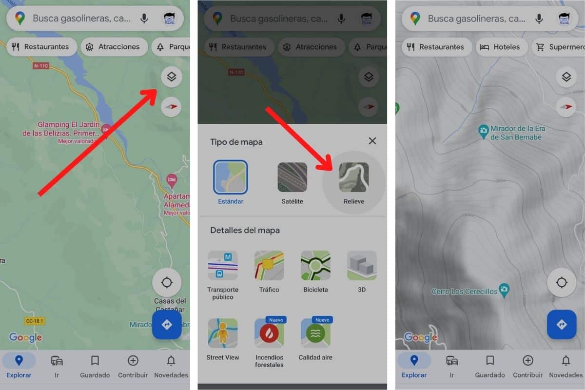
If we are using the mobile, it is simply a question of clicking on the button Layers on the right side of the screen and select «Relief«.
In the computer
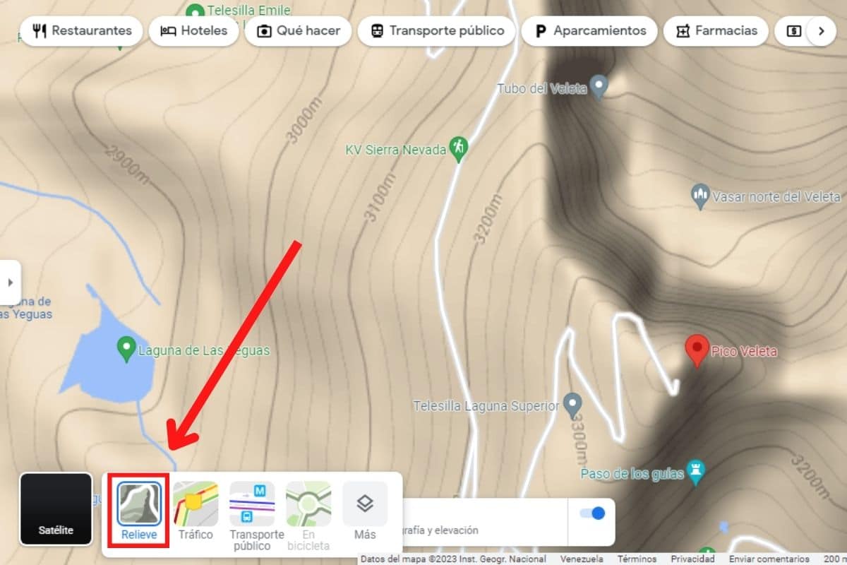
If we are on the computer, we must pass the cursor over the button Layers at the bottom of the screen to see more options and select «Relief«.
What happens next? Whether we use this tool on the PC or through the mobile, in the relief mode we can see some lines around the mountains. In each of them the height of that section is indicated. Obviously, this mode is going to be more useful for knowing the altitude of mountains in rural and wilder areas, although not so much in urban areas.
Apps to know the altitude data
In addition to Google Maps, there are many other tools to know at what altitude we are at all times. We refer to the numerous apps for both iPhone and Android phones, which incorporate altimeters and similar systems.
While these kinds of apps are usually free, there are some that offer paid versions with more added features and other tools. Of course, not all offer the same degree of precision, as we explain later. Best of all, these apps can work quite well offline. This is our small selection:
free altimeter
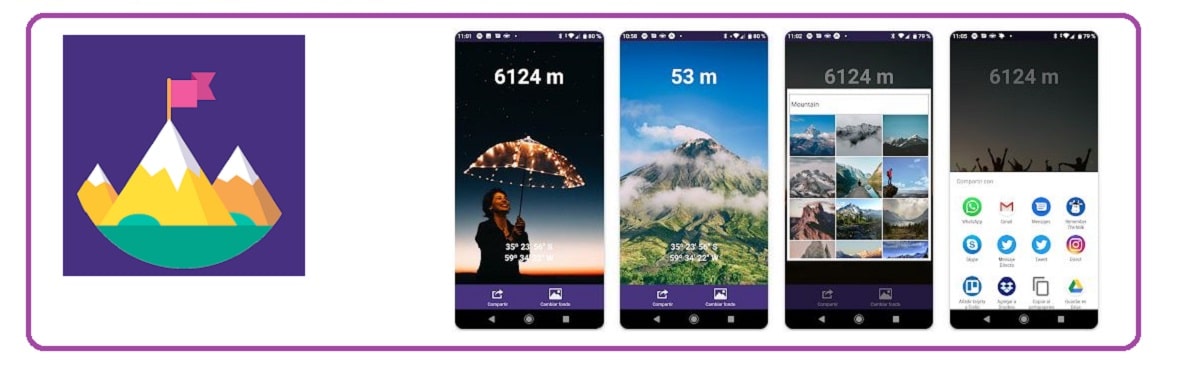
Only available on Android, the app free altimeter It is very easy to understand and use. All we have to do, once downloaded and installed on our phone, is to open it and we will automatically know the exact data of our current altitude with respect to sea level.
It also allows us to save and share this data. What does that work for? For example, if we are on vacation in the mountains, we will be able to photograph a landscape and insert the altitude data, to have a nice memory or send the image to our friends and family.


offline altimeter
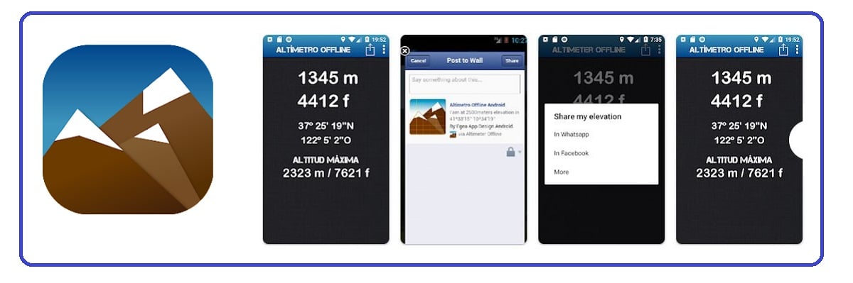
The great advantage of the app offline altimeter is that it helps us to know the data of the altitude, even when we are far away, in the middle of nature, without access to an Internet connection. This makes this app the ideal companion for trekking, climbing, and other outdoor activities.
The free version more than fulfills everything we need from this altimeter, although it also has a lot of ads, which can be annoying. But that is compensated by the extreme precision of the results it offers, something really remarkable.


My Elevation
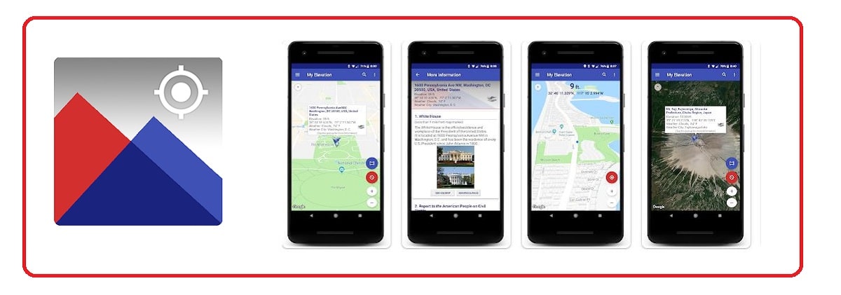
Another magnificent application, totally free, capable of providing us with valuable information about the current altitude and other interesting data. My Elevation It offers measurements quickly and reliably, both in meters and kilometers and in feet and miles.
Beyond the altitude, the app offers us data about the speed, distance and time traveled during our journeys and excursions through nature. It also adds a practical compass to guide us and allows us to record our routes with the date and all the information.

Barometer and Altimeter
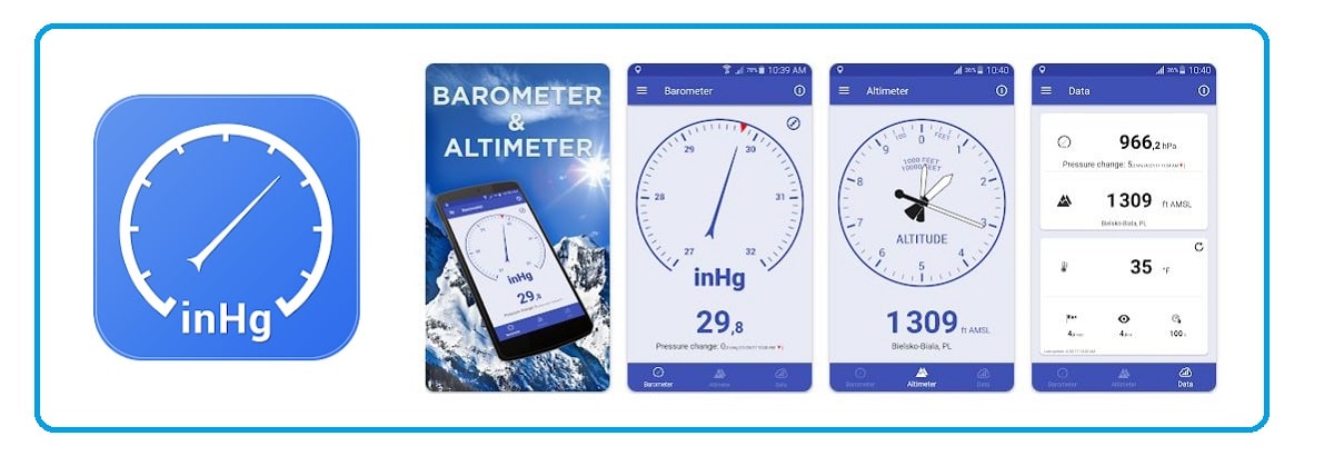
As its name indicates, Barometer and Altimeter It is an app with a double function: on the one hand, it provides us with the data of the current altitude and, on the other, that of the atmospheric pressure. Two aspects that are closely linked to each other, since the higher the altitude, the lower the atmospheric pressure and vice versa.
Available for both iOS and Android, this app is highly reliable and very easy to use. Includes a GPS and pressure sensor. And all for free, let's not forget.


Downloading and installing any of these applications on our mobile device is going to be a great idea to undertake any type of outdoor experience more safely, since these are completely reliable tools. In addition, it will always be cheaper and more comfortable than buying a handheld altimeter (this gadget is sold for at least 20 euros), which will also take up space in your backpack.